The Big Cypress Stewardship District (BCSD) consists of 22,000± acres located in Collier County and is a mixture of lands that have continuously been used for agricultural operations since the early 1900s as well as natural areas which include Shaggy Cypress Swamp and the Camp Keais Strand flow-way. The BCSD is located within Collier County’s Rural Lands Stewardship Area.
The BCSD is located within Collier County’s Rural Lands Stewardship Area (RLSA). The RLSA program is an incentive-based land use overlay system that encourages smart growth patterns in rural areas of the county. For those projects, whose proponents choose to participate in the RLSA Program, compact development at higher densities is directed to areas that have been mapped as having limited natural resource values and employs the use of stewardship credits to entitle development.
Stewardship credits are generated by establishing Stewardship Sending Areas (SSAs) which require removal of various layers of development rights from the property to generate credits. The number of credits generated by an SSA is based on the number of layers removed, the ecological value of the land, and if restoration work is proposed and implemented. The ecological value is determined using a Geographic Information System (GIS) model called a Natural Resource Index Assessment. These credits are then used to entitle developments which are referred to as Stewardship Receiving Areas (SRAs). There are multiple proposed SRAs and SSAs located within the BCSD.
Shaggy Cypress & Camp Keais Agricultural Developments
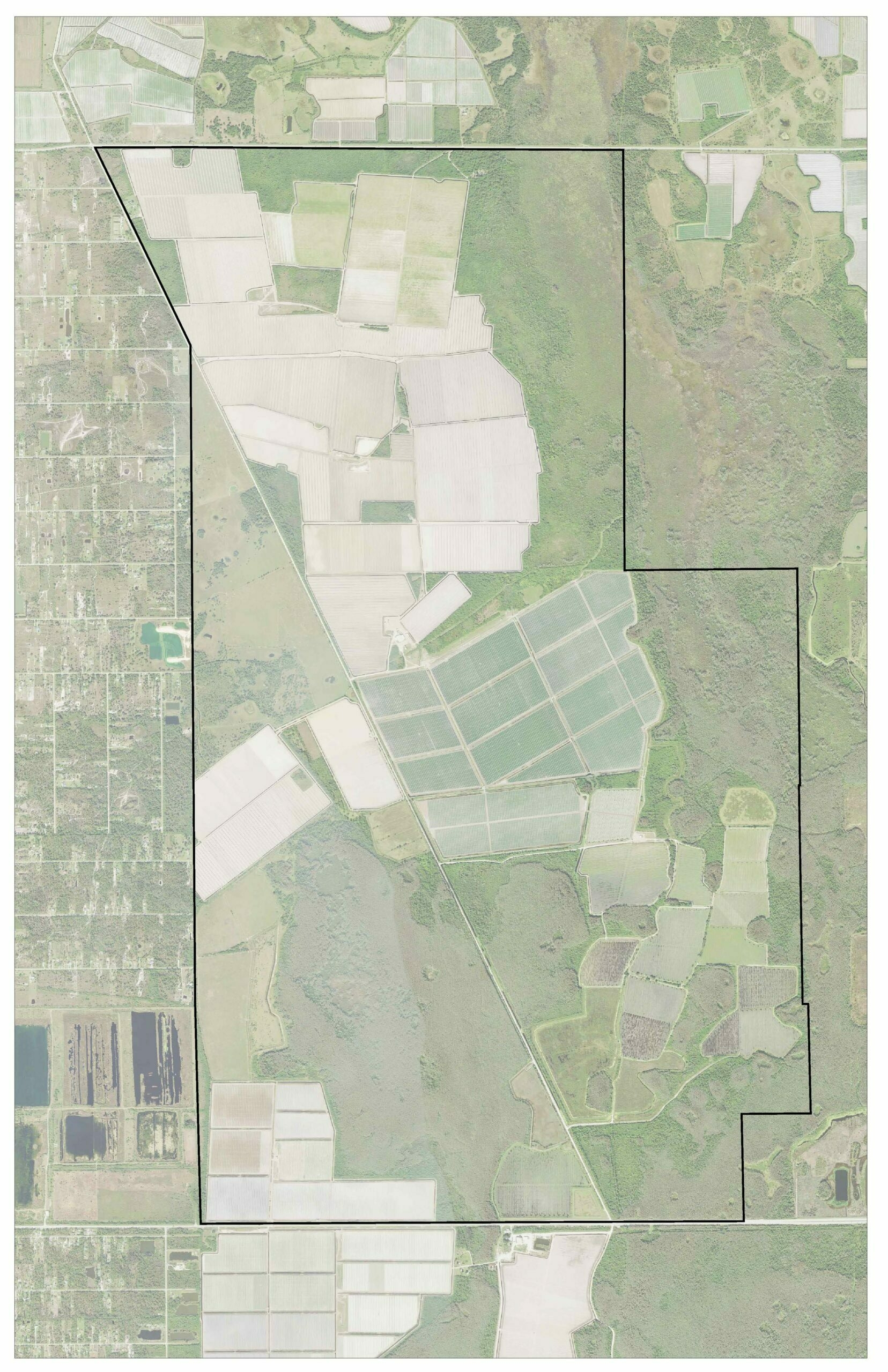
Shaggy Cypress and Camp Keais agricultural lands have been in production for many decades. We aided in obtaining state and federal permit modifications for the agricultural operations for the reconfiguration of their surface water management system. In addition, we have provided mitigation and monitoring oversight for the corresponding wetland mitigation and Florida panther habitat compensation areas. Field work has included vegetation and wetland mapping, wetland delineations, protected species surveys, and vegetation monitoring.
Rural Lands West
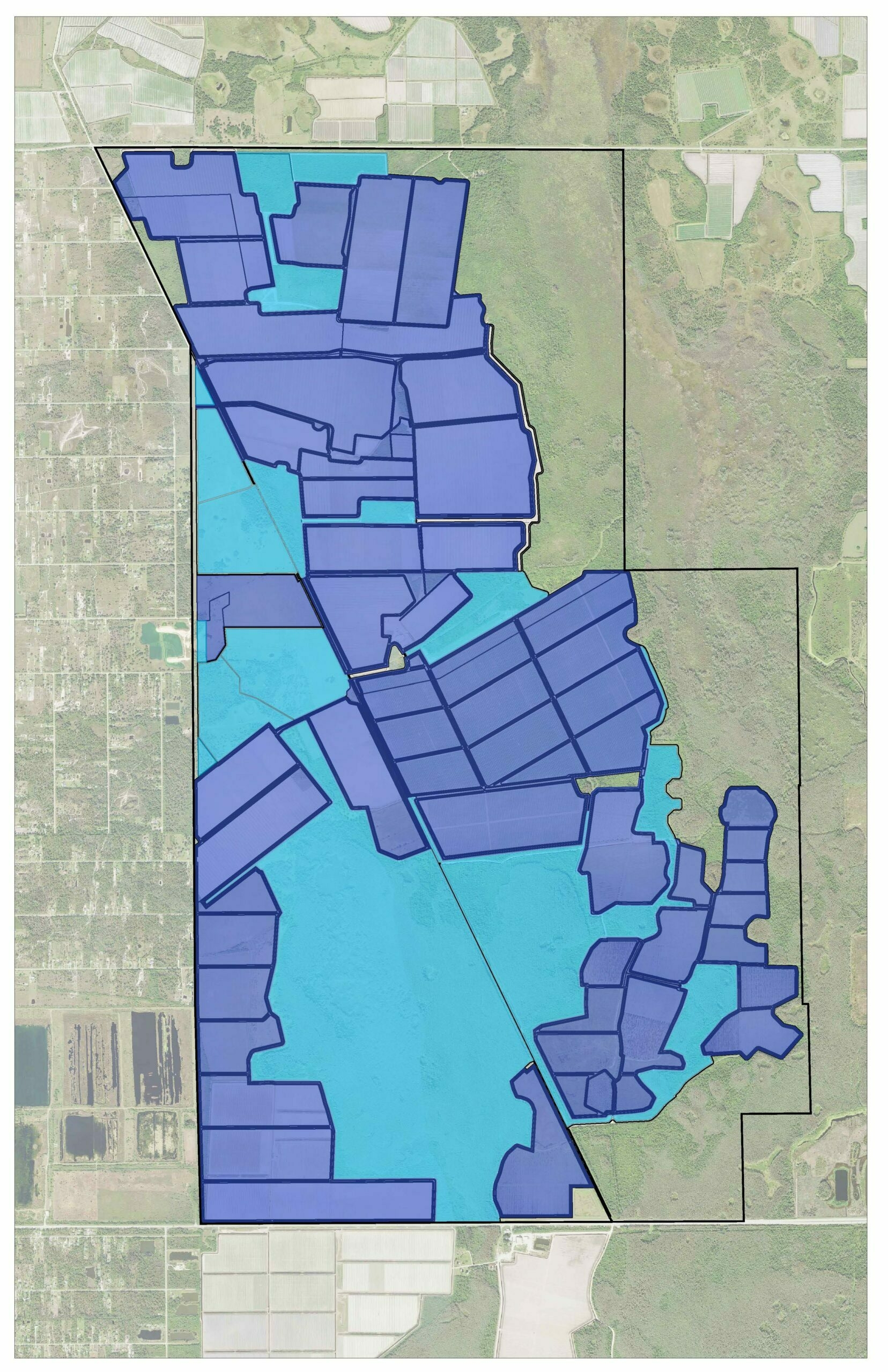
We assisted in state and federal permitting for a mixed-use project known as Rural Lands West which is located on an over 10,000-acre site. We coordinated with wildlife agencies and Non-Government Organizations to develop a plan that focuses development on existing agricultural fields and incorporates a lake buffer system to deter large mammals and minimize human-wildlife conflicts. Preserves were designated in environmentally sensitive and significant areas such as Camp Keais Strand and Shaggy Cypress Swamp and includes over 4,500 acres of habitat restoration, enhancement, and preservation. The design also includes wildlife crossings and corridors to maintain habitat connectivity for large mammals.
Permitting included a South Florida Water Management District Environmental Resource Permit application and a U.S Army Corps of Engineers 404 Permit application. Field work has included vegetation and wetlands mapping, wetland delineation, listed species surveys, crested caracara surveys, Florida bonneted bat acoustic surveys, red cockaded woodpecker surveys, southeastern American kestrel surveys, and Everglades mink camera trap surveys.
Rivergrass Stewardship Receiving Area (SRA)
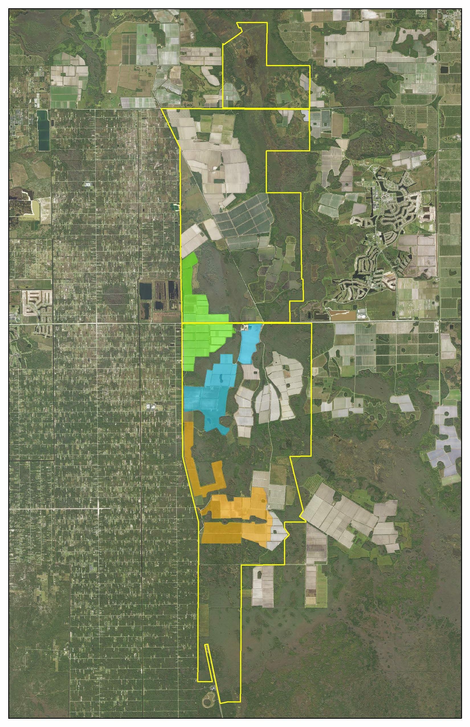
Rivergrass SRA is located within the footprint of Rural Lands West and is a 998-acre village that received county approval under the RLSA program. Under this program, Rivergrass is designated as a Stewardship Receiving Area. Local permitting efforts included preparing an SRA application and Natural Resource Index Assessment.
Longwater SRA
Longwater SRA is also located within the footprint of Rural Lands West and is a 999-acre village that is pursuing county approval under the RLSA program. Under this program, Rivergrass is designated as a Stewardship Receiving Area. Local permitting effort included preparing an SRA application and Natural Resource Index Assessment.
Bellmar SRA
We have worked on pursuing local, state, and federal permitting for Bellmar SRA. Bellmar is located on an over 5,000-acre site and like Rural Lands West, focuses development within existing agricultural fields and utilizes a lake buffer system. Preserves for the Project include lands within and adjacent to Camp Keais Strand and the Florida Panther National Wildlife Refuge. These preserves are comprised of over 2,500-acres of habitat preservation and enhancement.
Permitting efforts include an SRA application, including a Natural Resource Index Assessment, a South Florida Water Management District Environmental Resource Permit application, and U.S Army Corps of Engineers 404 Permit application. Field work has included vegetation and wetlands mapping, wetland delineation, listed species surveys, crested caracara surveys, Florida bonneted bat acoustic surveys, red-cockaded woodpecker surveys, southeastern American kestrel surveys, and Everglades mink camera trap surveys.
Stewardship Sending Areas (SSAs) 14, 15, 16, 17, & 18
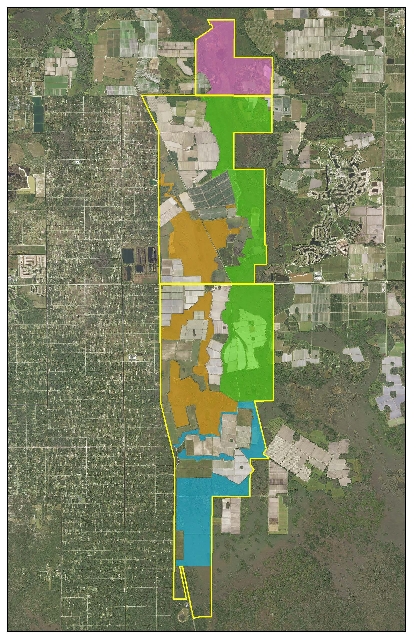
We have been working on modifications to SSAs 14, 15, and 16 to remove additional land use layers and designate areas for restoration. We have also worked to establish two new SSAs, SSAs 17 and 18. The location of these SSAs in the landscape results in a network of preserve land that connects Corkscrew Regional Ecosystem Watershed (CREW) Lands to Camp Keais Strand and the Florida Panther National Wildlife Refuge, creating a regionally significant ecological corridor of preserve land. Our involvement in this work included updating the Natural Resource Index assessments to reflect the removal of additional land use layers and incorporating additional field verified data collected by us. Field data collected included vegetation mapping and listed species observations.