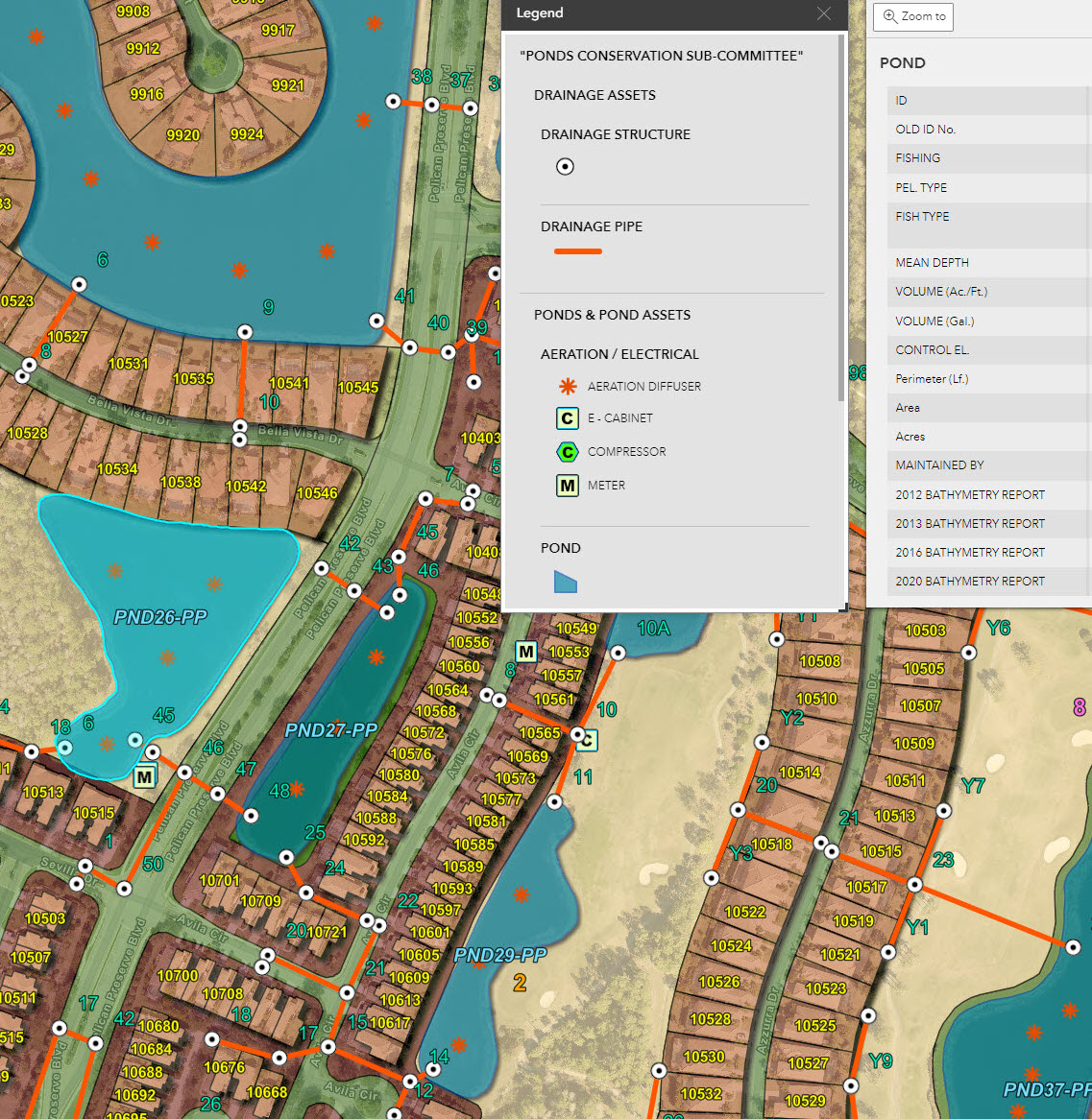
GIS solutions can help manage and maintain a community and all its assets with convenience and efficiency.
Developing a GIS database that contains utilities, irrigation, drainage structures/pipes, easements, preserve area limits, lakes, rights-of-way, construction documents, PLATs, and more, allowing convenient 24/7 access, making communication, management, and maintenance tasks smooth and easy. There is no limit to what data or function can be built into a GIS database.
Most images provided and copyrighted by Sr. Ecologist and nature photographer William R. Cox. To order prints, please visit www.williamrcoxphotography.com
© 2024 Passarella & Associates, Inc. All Rights Reserved. Support by Gifted Owl | Privacy Policy | Cookie Policy | Accessibility Policy


